MOUNTAIN VIEW COUNTY - Jason Nixon, an area MLA and provincial minister of Environment and Parks, has updated Mountain View County council on the Upper Red Deer River Hazard study.
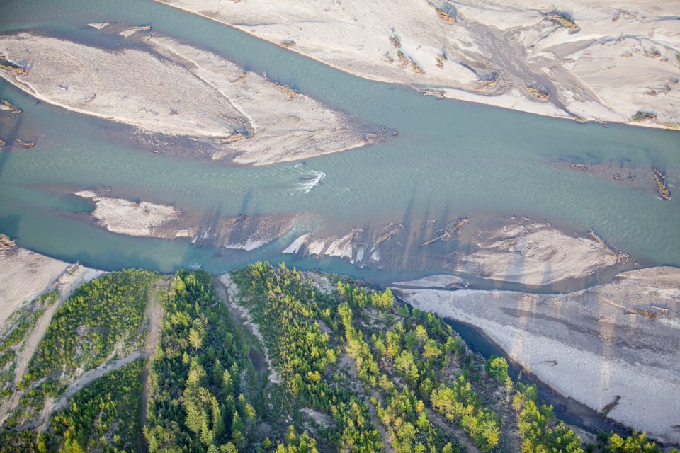
Started in 2017, the study is being conducted to assess and identify river and flood hazards. It includes hydrology assessments, hydraulic river modelling, flood inundation mapping, flood hazard mapping, flood risk assessment and inventory, and channel stability investigation.
In a letter to council received at a recent council meeting, Nixon responded to questions recently forward to his ministry by the county, including asking for an update on the study.
“I appreciate the county’s concerns regarding the anticipated release of the Upper Red Deer River Hazard study,” said Nixon, who is the Rimbey-Rocky Mountain House-Sundre MLA.
“Substantial progress has been made to date, and technical work is expected to be completed this summer. Municipal review and pubic engagement for major components of the study will be conducted as it is finalized. We want to provide useful tools to communities and the public as soon as possible to support emergency response and help build safer communities in Alberta.”
According to a release from the province, the survey and base data collection, hydrology assessment, hydraulic modelling and flood inundation mapping work is now completed.
Flood hazard mapping and channel stability investigations are in the late stages and are expected to be completed soon.
“Flood hazard mapping divides the 100-year floodplain into floodway and flood fringe zones, to identify where flooding is deepest and most destructive,” study officials said. “These maps can be used to help guide long-term development planning.
“Flood maps for 13 different sized floods, based on hydraulic model results and the hydrology assessment, will be produced. Flood inundation maps can be used for emergency response planning and to inform local infrastructure design. These maps identify areas of direct flooding and area that could be flooded if local berms fail.”
In his letter to council, which was received as information, Nixon said, “I assure you Environment and Parks and Municipal Affairs will continue to work together with municipalities in support of provincial flood hazard management policies and programs.”
The study is being co-funded through the federal National Disaster Mitigation program. More information on the study can be found at floodhazard.alberta.ca.
In his letter, Nixon also commented on a number of other projects, including work underway to update the provincial Code of Practice of Asphalt Paving Plants.
“In consultation with Alberta Transportation and stakeholders, including rural municipalities, the department will look at revising requirements in the code for air, wastewater, waste management, conservation and reclamation, as well as improving enforceability,” Nixon said.
The province is also updating the requirements for pits though the Sand and Gravel Program Review.
“Staff are developing more detailed conservation and reclamation requirements for pits, which incorporate progressive reclamation, based on what they heard at stakeholder engagement sessions,” he said.
“We are committed to reviewing the updated requirements with rural municipalities to ensure the requirements are practical and responsive to the needs of Albertans.”
Nixon also said he commends the county for its “proactive approach and local efforts to recycle agricultural plastics, and I appreciate your recommendations to adopt a provincially regulated extended producer responsibility recycling program for agricultural plastics.”


