MOUNTAIN VIEW COUNTY - County council has given first reading to the Olds-Didsbury Airport area structure plan (ASP) and set the public hearing for later this month.
The move came by way of motion at a recent, regularly-scheduled council meeting, held in person and online.
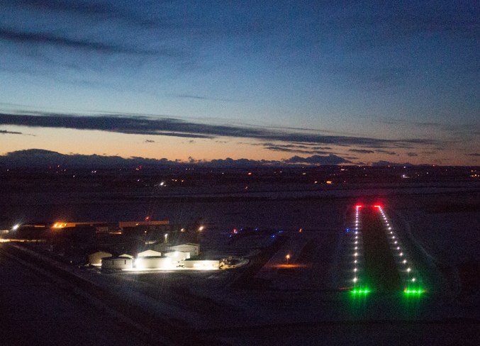
The current airport ASP was approved in 2006 and is being updated to provide direction for the future subdivision and development of the county-owned facility, located along Highway 2A between Didsbury and Olds.
A multi-stakeholder steering committee is overseeing the new ASP, developing policies that will support the future potential of the airport to grow while also ensuring the safety of airport operations and aircraft that manoeuvre surrounding the airport.
The plan development process has involved several steering committee meetings and a Jan. 16 open house at the county office.
A number of key changes are being proposed, including expansion of the plan boundaries, updated height limitations mapping, updated noise exposure projection mapping, and limitations on location of new county residential district subdivisions.
Regarding plan boundaries, the original plan area consists only of the two quarters that contain the current footprint of the airport, along with the expansion area of the airport when that may occur in the future.
“The steering committee’s direction was to include within the ASP boundaries all lands that are directly impacted by the airport’s height limitations and noise exposure projection areas. This is an increase from the current two quarter sections to 31 quarter sections,” administration said in a briefing note to council.
Regarding height limitations, the note states, “the intention of height limitations mapping is to show the allowable height of development that can occur along the take-off and landing areas of the airport’s runways. Since the original ASP was adopted, the airport’s main runway has expanded.
“The (steering committee) wanted to update this map to ensure it reflected the current standards for protecting the runways from the height of nearby surrounding structures, while also protecting the take-off and landing areas of a potential future expanded runway of a maximum additional 206 metres (675 feet). The new map is based on the potential of an expanded runway, should that occur in the future.”
As well as giving the updated bylaw first reading on March 27, council also set the public hearing date for April 24.
The complete Bylaw No. 7/24 Olds-Didsbury Airport area structure plan is available for viewing on the county’s website.


